About This Park
With 8,101 acres of dense forest, Holly River is West Virginia's second largest state park and known for its wide range of flora, including wildflowers and ferns. Located in a narrow valley in the Mountain Lakes region, the park is surrounded by heavily forested mountains, some reaching more than 2,800 feet in height. The dense forests of Holly River provide guests with a natural setting where they can find peaceful solitude. Recreational opportunities in this park include camping, hiking, swimming and tennis. Amenities include picnic shelters, corrals for campers with horses and the Cookhouse at Holly River State Park.
Contact
- Phone: 304-493-6353
- Email: hollyriversp@wv.gov
- Address: 680 State Park Rd., Hacker Valley, WV 26222
History
The area now known as Holly River State Park was settled around 1870 by a group of immigrants from Switzerland. After years of the land being stripped of useful timber, the U.S. Department of Agriculture began purchasing land, and in 1937 began reforesting and restoring the area to the deep woodlands enjoyed by visitors today. In 1938, Holly River was designated a wildlife refuge and opened as an official state park, but it wasn’t until 1954 that the federal government deeded the land to the state of West Virginia. Since then, many trails have been blazed, cabins have been refurbished and campsites have been constructed. Other improvements have included the construction of game courts, a swimming pool and other outdoor recreational facilities enjoyed by hundreds of visitors each year.
Trails
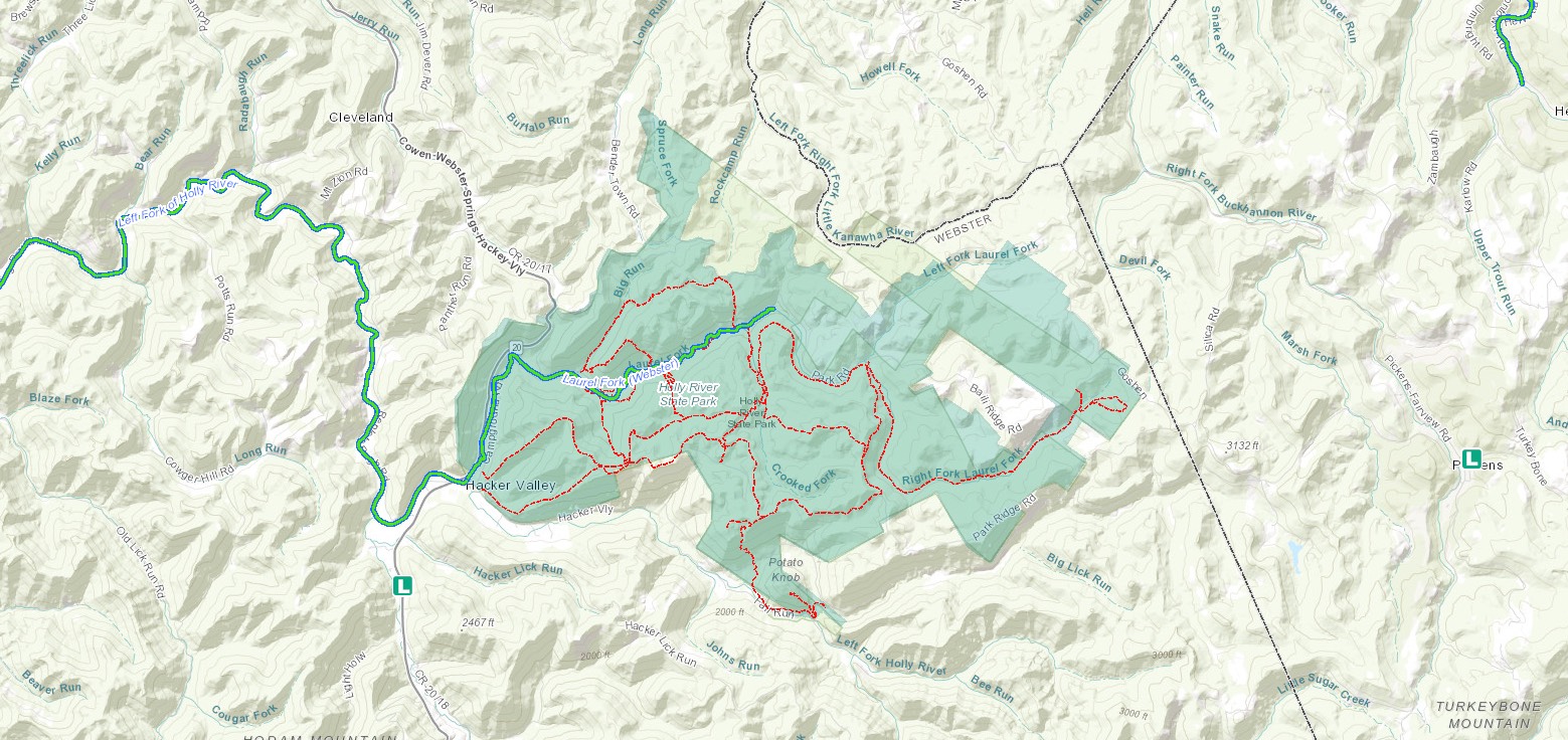
Download Park Trail MapHigh Rock Trail
Laurel Fork Trail
Nature’s Rock Garden Trail
Oak Ridge Trail
Potato Knob Trail
Railroad Grade Trail
Reverie Trail
Ridge Road Trail
Salt Lick Trail
Tramontane Trail
Wilderness Trail
Additional Information
Picnicking
Holly River offers seasonal recreation and nature programs and a trout-rearing pond with facilities ideal for picnics and reunions. There are two large pavilions that may be rented by the day. Shelters are reservable up to a year in advance with a picture-perfect trout rearing pond located near the park headquarters. Guests can learn about the many types of trout that are stocked in the park and the importance of protecting them for the generations to come.
Dining
The Cookhouse is a one-of-a-kind, full-service restaurant. Local restaurateur Cristi Vason operates the state park system’s coziest dining venue. The Cookhouse at Holly River State Park will feature a selection of fresh and locally sourced items sure to please all ages and tastes.
The Cookhouse is open from 8 a.m. to 8 p.m. every day – Memorial Day – Labor Day.
Nearby Attractions
Audra State Park
This beautiful state park is situated in a heavily wooded area with riverside camping along the Middle Fork River. Hiking, picnicking, swimming and canoeing are popular outdoor activities for you to enjoy.
Kumbrabow State Forest
This state forest is operated for multiple uses, including hiking, wildflower and wildlife viewing and picnicking. Kumbrabow has fully equipped pioneer cabins to share with family and friends.
West Virginia State Wildlife Center
The West Virginia State Wildlife Center at French Creek is a modern zoological facility displaying native and introduced state wildlife. Operated by the Wildlife Resources Section of the West Virginia Division of Natural Resources, the Wildlife Center is dedicated to presenting visitors a realistic and factual understanding of our state’s wildlife. The Wildlife Center is located about 20 miles from Holly River State Park.
Elk Springs Resort
Unwind at this luxurious fishing getaway, where trout are plentiful. Get help from professional guides or load up at the fly shop— the largest in West Virginia. Stylish lodging and cabins make your mountain stay complete.


