Fairfax Stone State Park Overview & History
Park Overview
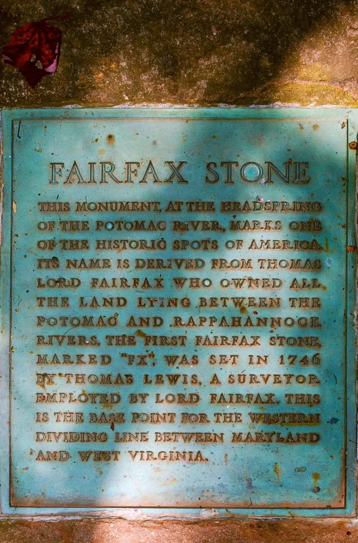
Fairfax Stone State Park is comprised of four acres and named after the Fairfax Stone, a surveyor’s marker and boundary stone used in the 1700s to settle a dispute over land in the English colonies of Maryland and Virginia. One of the oldest markers in the United States, the stone rests at the junction of Tucker, Grant and Preston counties and marks the boundary between Maryland and West Virginia.
Park History
The Fairfax Stone marks the western boundary of land granted to Lord Fairfax by the King of England in the 1700s. Two centuries later, the stone was used to determine the boundary between West Virginia and Maryland. Over the years, the stone has been changed out for various reasons. The current Fairfax Stone, the fifth, was dedicated as a state historic monument and became part of the West Virginia State Park system in 1957 when the Western Maryland Railroad gave four acres of land surrounding the stone to the state. In 1970, the stone was listed on the National Register of Historic Places.