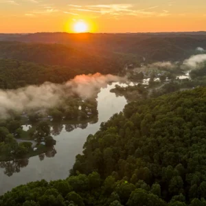
Take on a Mountaineer Mile Trail in West Virginia State Parks
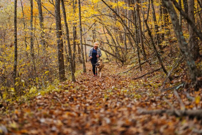
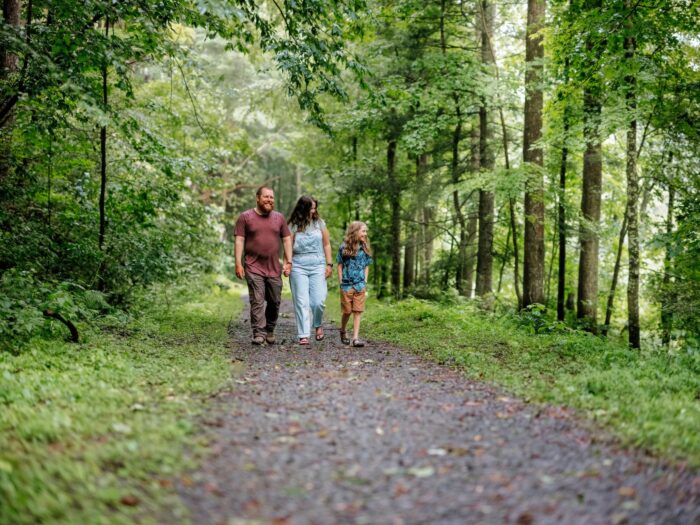

There is no better place to get outside and get moving than West Virginia’s stunning state parks! 🥾When Governor Morrisey launched the Mountaineer Mile to encourage West Virginians to walk at least one mile daily, parks were the perfect place to start. Governor Morrisey has designated an official Mountaineer Mile trail in 44 state parks – so browse the parks below and kick off your health journey.

| PARK | DETAILS |
|---|---|
| PARK/DESTINATION – TRAIL | TRAIL DESCRIPTION |
| Audra – Alum Cave Trail | Begin at the main parking lot and hike to the marked turnaround point for a one-mile round trip. |
| Babcock – Lake View Trail | Park at Boley Lake and follow the trail around the 18-acre lake for a scenic loop. |
| Beartown – Beartown Boardwalk | Enjoy a 0.5-mile walk along a boardwalk through unique rock formations. |
| Beech Fork – Fitness Trail | A one-mile paved loop trail near park headquarters, circling the day-use area. |
| Blackwater Falls – Lindy Point Overlook Trail | Start at the lodge parking lot trail off of Canaan Loop Road to a scenic overlook of the Blackwater River. Turn around to complete the walk. |
| Blennerhassett Island – Lovers Lane Trail | Begins at the ticket booth on the island and passes by the WV swing, black walnut grove, mansion, and other historic features. |
| Bluestone – Rhododendron Trail | Start across the road from the Event Building and walk out to the turnaround marker and back. This trail features WV’s state flower and may have silt deposits from recent flooding. |
| Brush Creek – Brush Creek Falls Trail | Begin at the Brush Creek parking area and follow the trail to Brush Creek Falls. Continue 300 yards past the falls before turning around. |
| Cabwaylingo – Long Branch Historic Trail | Starts and ends in the Long Branch Picnic Area. Features include CCC stonework, historic picnic shelters, and a crescent-shaped fireplace across the footbridge. |
| Cacapon Resort – Rock & Roll Trail | This 1.2-mile loop begins in the Picnic Area below the Nature Center and features a gentle elevation gain of 89 feet. |
| Camp Creek – Turkey Loop Road and Trail | Park at the Campbell Falls parking area and enjoy a scenic out-and-back walk to the CC Horse & Rider Campground. |
| Canaan Valley Resort – Blackwater River Trail | This one-mile loop passes through hardwood forests and follows a winding section of the Blackwater River. |
| Carnifex Ferry Battlefield – Patterson Trail | Park at the Patterson House Museum and follow the trail to the turnaround marker before returning to your starting point. |
| Cass Scenic Railroad – Greenbrier River Trail, Northern Terminus | Begin across from the Cass Company Store and walk south to the new campground before returning to the store. |
| Cathedral – Cathedral Trail | This 1.1-mile loop crosses multiple bridges over Rhine Creek and is the longest trail at Cathedral. |
| Cedar Creek – Fishermans Trail | Begins behind the park office and leads toward the Park View Trail. Follow to the 0.5-mile turnaround marker and return. |
| Chief Logan – Fitness Trail | Begins at park headquarters and follows a loop trail alongside a stream and road. Total distance is 1.1 miles. |
| Coopers Rock – Roadside Trail | Park at the reservoir lot and hike north on Roadside Trail, west on Chestnut and Headwaters Trails. Total distance out-and-back is 1.1 miles. |
| Droop Mountain – Cranberry Bogs Trail | Start at the park office and hike to the south picnic area through a mountain bog with unique plants and tall pines, then return. |
| Elk River Trail – Elk River Trail Dundon Trailhead | Begin at the Dundon Trailhead and hike south across the bridge to the turnaround sign before returning. |
| Elk River Trail – Elk River Trail Gassaway Trailhead | Begin at the Gassaway trailhead and head south towards the sign which will direct you to the turnaround point. |
| Greenbrier River Trail – Caldwell Trailhead | Park at the southern terminus of the Greenbrier River Trail and walk 0.5 miles near the Camp Allegheny lot, then return. |
| Greenbrier – YCC Trail | Originally a fitness trail, this figure-eight loop is just shy of a mile. Repeat one loop to complete your distance. Access from the picnic area. |
| Hawks Nest – Hawks Nest Rail Trail | Park below the town of Ansted on Mill Creek Road and walk toward Hawks Nest State Park on this rail trail. |
| Holly River – Laurel Fork Trail | Park at the Activities Building and walk the paved Laurel Fork Trail loop twice to complete one mile. |
| Kanawha – Davis Creek Trail | Trail access is near the Forest Headquarters. |
| Kumbrabow – Clay Run Trail | This trail begins near the Forest HQ. Hike 0.5 miles with a mostly flat grade, followed by an uphill return. |
| Little Beaver – Lake Front Trail | This 1.1-mile loop starts and ends at the lake parking area just below the dam. |
| Lost River – Loblolly Trail | Trail begins at the Loblolly Trail head, located at the end of the cabin road (between Cabin 24 and 25). Walk the trail 0.5 miles out to the turn around sign and walk the other half-mile back. |
| Moncove – Devil’s Creek Trail | Park at Shelter 1 and pick up Devil’s Creek trail at campsite 40. Follow this trail downstream for approximately 1/2 mile before turning around at the Mountaineer Mile turnaround sign and returning to your starting point. |
| Morgantown – Center for ActiveWV Loop | The Center for ActiveWV Loop is in the Center of West Virginia University’s Evansdale campus and features flat, gravel terrain for an easy 0.4-mile lap. |
| North Bend Rail Trail – Salem Trailhead | This trail is located near the restored train station in Salem. |
| North Bend SP – Access Trail | This out-and-back trail begins at Shelter 3 and makes for an easy one-mile hike. |
| Panther – Twin Rocks Trail | Park at the Bonner Shelter and follow the trail to the forest office, then return via Panther Creek. |
| Pinnacle Rock – Homestead Trail | Homestead Trail starts behind the picnic shelter and leads downhill to an old log homestead before returning uphill. |
| Pipestem – Den Tree Trail | Park at the Splash Park lot across from McKeever Lodge. Begin in the arboretum and hike 0.5 miles to the turnaround marker, then return. |
| Pricketts Fort – MCTRAIL | Access the Marion County Rail Trail from Pricketts Fort State Park. Walk 0.5 miles out and return. |
| Seneca – Michael Mountain Road | Park at the picnic area entrance and walk along Michael Mountain Road to the wildlife viewing area, then return. |
| Stonewall Resort – Lakeside Nature Trail | Start at the trailhead for Lakeside Nature Trail on the northern side of Carrier Bay and hike 0.5 miles out, then turn around and return. |
| Summersville – Pirates Cove Trail | Park at the Hughes Ferry Day Use area and walk 0.5 miles out on this trail, then return for a full mile. |
| Tomlinson Run – Jody Hulka Trail | This trail is a short 0.25-mile trail along the North Fork of Tomlinson Run, ending at an Almost Heaven Swing. Walk it twice in both directions for a full mile. |
| Twin Falls – Cliffside Trail | Trailhead is in the Bear Wallow Campground near the Fox Hunters Bathhouse. Hike 0.5 miles to a turnaround point and return. Continue to scenic overlooks for more mileage. |
| Tygart Lake – Water Park Trail | Water Park Trail is a 0.5-mile out-and-back walk. |
| Valley Falls – Deer Trail | Walk 0.5 miles out to the turnaround point and return for a one-mile round trip. |
| Watoga – Lake Trail | Lake Trail is a mostly-level loop trail circling Watoga Lake. Access from the boat docks, dam, or pool parking area. |
| Watters Smith – Barn Burner Trail | Walk 0.5 miles out to the turnaround point and return for a one-mile round trip. |