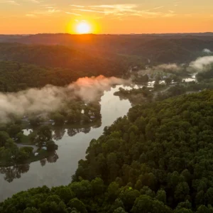
Tygart Lake State Park Trails
Tygart Lake State Park features six hiking trails to gaze over gorgeous greenery and lakeside. Whether you seek a calming stroll or a challenging climb, the trails feature variety for every explorer. There is access to different picnic areas and park campsites along the trails for an easy journey toward outdoor recreation.
Easy to Moderate
Lake Trail – 0.5 Miles
This trail begins at Picnic Area Number 3 and follows a small stream to the lake. Please take caution, as the trail has a few hills.
Ridge Trail – 0.75 miles
The trail begins near the park office and ends at Picnic Area Number 1. This trail is ideal for some eye-catching forestry and various types of wildlife. Please take caution around the steep hills.
Tygart Dam Trail – 0.75 Miles
This trail begins near the lodge and follows near the lakeshore before ending at the dam. This trail has a few hills and is approximately .75 miles long.
Moderate
Dogwood Trail – 2 Miles
The trail begins opposite Dam Trail near the lodge, passing through the forest with numerous dogwood trees. The trail climbs to a higher elevation above the lodge, following a ridge top and descending back on the park road from the dam.
Woodland Trail – 1.5 Miles
This trail is located on the southern end of Tygart Lake beginning near the park office. It passes through what was once a farm before ending between Cabin 5 and the campground. The trail takes hikers over hills but is mostly level throughout.
School Bus Trail – 2 Miles
This trail begins near campsite 21 and is an intermediate directional trail. It makes a 2.0-mile loop on the south end of the park. You will see remnants of old farmhouses and a rock cliff overhang along the way. Mountain bikers will zoom across hill climbs, rock gardens, banked turns and more. What more could you ask for?
Other ways to navigate our trails*


Additional information may be available in the West Virginia Trail Inventory
*Trail data may vary between services.