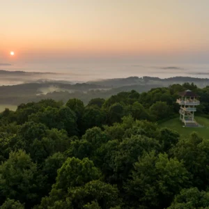
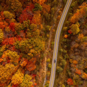
North Bend State Park Trails
Stretch your legs and clear your mind with over 25 miles of riveting trail adventures. There are 17 hiking trails with moderate grades yet changing treads, but the gorgeous landscapes are worth the journey. North Bend State Park also boasts an excellent spot for bikers to access the 72-mile North Bend Rail Trail.
Easy
Fisherman Trail – 1.3 Miles
This trail can be used to access fishing along the lake shore. The trail begins by the Cokeley Recreation Area boat dock and runs along the lake shore to the Jughandle Day-Use Area.
Giant Pine Trail- 0.6 Miles
This trail begins and ends across from the lodge. It is a beautiful hike through a white pine thicket offering views of birds, deer and other wildlife. It features moderate grades, smooth tread and changing sight lines.
Giant Ree Trail – 0.5 Miles
This short, flat trail links the picnic area with the playground area. Large oak, beech and poplar trees may be seen throughout this old-growth certified forest. It features moderate grades, smooth tread and good sight lines.
Gibbons Nature Trail – 0.25
This is a short backtrack trail dedicated to the late natural foods advocate Euell Gibbons, featured at early Nature Wonder (Wildfoods) Weekends held annually at the park. The trail begins beside the pond and ends near the swimming pool parking lot. It features a gentle grade with rough tread and good sight lines.
Hibbs Cemetery Trail – 1 Mile
This trail begins in the pond area with a rocky climb and follows the ridge to the Hibbs Family Cemetery. The trail will end behind the lodge. It features a constant grade with changing tread and good sight lines.
Moderate
Access Trail to North Bend Rail Trail – 0.8 Miles
This roadbed provides access for hikers, bikers and horseback riders to the North Bend Rail Trail. Access Trail begins in the recreation area near Shelter #3 and ends at the rail trail. Featuring 11 tunnels and 32 bridges, the North Bend Rail Trail is 72 miles long, with North Bend State Park at the midpoint. Parking is available.
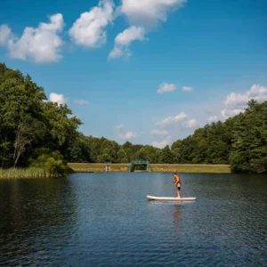
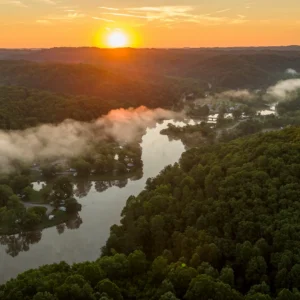
Barton’s Lake Trail – 3 Miles
This trail is accessible from the Overlook Trail, Jughandle Day-Use Area and the Cokeley Recreation Area equestrian trailhead. Before climbing to the top of the ridge, the Fisherman Trail splits to your right to stay along the lake shore. Once you reach the top of the ridge, you’ll go downhill and see the other end of the Fisherman Trail on your right, near the dam. After passing some unique rock formations, the trail follows a gravel road around the base of the dam.
Castle Rock Trail – 0.3 Miles
This short spur is to the left of the dam off the Lake Trail. It features a large rock formation known as the Castle Rock. The trail has a moderate uphill grade with a rocky surface and good sight lines.
Rock climbing is available via Rivertown Kayaks and Climbing guide service located at base camp. Climbing areas include Castle Rock, Big Easy and Sunshine Wall.
Extra Mile Trail – 0.3 Miles
This is a self-guided, paved interpretive trail equipped with braille and English interpretive signs. At the end is a small deck that sits back in the woods along an intermittent stream. From this trail, you may access the Overhanging Rock Trail and the Access Trail.
Moderate to Difficult
Nature Trail – 4 Miles
This is one of the park’s longest trails. It begins and ends near the pond, circling part of North Bend and its facilities. The trail goes through habitats and allows viewing of expansive fern beds, fungi and rocky outcrops. It features moderate to strenuous grades, with changing tread conditions and sight lines.
Overhanging Rock Trail – 0.5 Miles
This trail begins at the entrance to the recreation area and ends at the Extra Mile Trail. It is an ideal hiking trail with a loop that features views you won’t see anywhere else in the park. The main view is a large rock formation in a cool ravine. It features moderate to strenuous grades.
Overlook Trail – 1.2 Miles
The trailhead is by the cabin supply building. Highlights include rock formations along the Hughes River and an overlook of the Hughes River Dam. It features moderate to strenuous grades with changing tread surfaces and sight lines.
Southern Railroad Trail – 1.5 Miles
This trail follows the old Harrisville Southern Railroad Grade that previously went from Cornwallis to Harrisville and now connects River Run Campground to the base of the Hughes River Dam. In the spring, abundant wildflowers may be seen on this trail.
Tanker Run Spur Trail – 0.8 Miles
Designed by mountain bikers, this trail provides a more rideable way out from the Nature Trail Loop. The grades change from moderate to flat, the tread is smooth and the sight lines are good.
Ten Acre Trail – 3 Miles
This trail was designed by mountain bikers to be ridden in a counterclockwise direction and features one big climb and one descent. The trail will begin at the park entrance and gently climbs to the top of the ridge before making its way back down the road.
Union Ridge Connector Trail – 0.2 Miles
This trail is a repurposed roadbed that connects the cabin area to Barton’s Lake Trail.
Water Edge Trail – 1.6 Miles
This trail connects the Cokeley Recreation Area boat ramp to the canoe launch area. The trail follows the lake below Cokeley Campground.
Other ways to navigate our trails*


Additional information may be available in the West Virginia Trail Inventory
*Trail data may vary between services.