About This Park

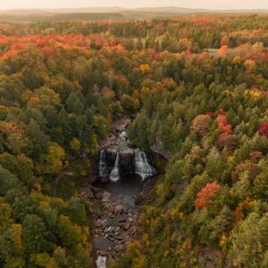
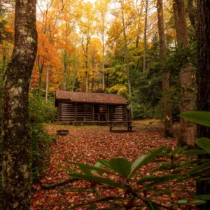
Covering 5,200 acres in southeastern West Virginia, Greenbrier State Forest delivers secluded natural beauty with a wide range of recreational options like fishing, swimming, hiking and mountain biking. The forest is just a stone’s throw away from the charming and historic towns of White Sulphur Springs and Lewisburg, so visitors can enjoy a day of solitude communing with nature, then venture out for shopping, dining and the arts. With cabins and camping, Greenbrier State Forest is also an ideal base camp for bicyclists on the neighboring Greenbrier River Trail.

Note: When traveling to Greenbrier State Forest, vehicles and campers will need to travel through Harts Run Tunnel, which is 13’ 6” high.

Accommodations

Select an option below to learn more about the accommodations at this park.

Activities

Select an activity below to learn more
  • Biking
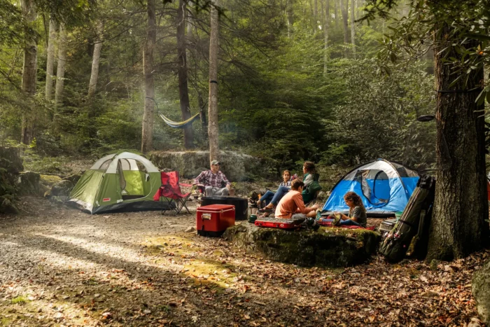
  • Camping
  • Fishing
  • Golf
  • Hiking
  • Horseback Riding
  • DeerViewing
    Hunting
  • Museums & Historical Sites
  • Outdoor Adventures
  • Rafting
  • Swimming
Attraction is located outside of the park.

History

This 5,133-acre forest was purchased by the State of West Virginia from the White Sulphur Springs Park Association in 1938. That same year, the Civilian Conservation Corps established Camp White Sulphur, in the area that presently houses the Forest headquarters and swimming pool. The forest, which stands divided by 3,280-foot high Kate’s Mountain, is rich in Native American history dating back to the 1700’s.

Trails

Download Park Trail Map

Black Bear Trail

Starting points are three-tenths of a mile from the cabin area at an intersection with Old Roads Trail and one-fifth of a mile from the main forest road on Young’s Nature Trail. The trail passes through two hollows with a gentle climb in elevation. This trail can be combined with Old Roads Trail to make a longer hike.

Distance: 2 miles (one way)

Difficulty: Moderate

Holsapple Trail

Following an old logging road for its entire length, this trail begins at the top of Kate’s Mountain near Rocky Ridge Trail. After skirting the eastern side of Kate’s Mountain, it ends on Kate’s Mountain Road, south of Young’s Nature Trail.

Distance: 2.3 miles (one way)

Difficulty: Moderate

Kate’s Mountain Loop Trail

A loop that combines the Rocky Ridge, Holsapple, Young Nature and the Mabel Dowdy trails, as well as the western service road. Adventurers with the backpacker spirit will enjoy the variety this loop offers. Nevertheless, you may want to pack a lunch for this walk.

Distance: 7.8 miles

Difficulty: Difficult

Mabel Dowdy Nature Trail

This trail, named after a retired park employee, begins and ends in the cabin area. A nice after-dinner trail, it visits a variety of plant and animal habitat including a mixed deciduous hardwood forest, a hemlock forest, a mountain stream habitat and an open meadow. This trail has a few gentle climbs.

Distance: 1.3 miles

Difficulty: Moderate

Old Field Loop Trail

Walking time 1 hour. This loop trail, which is bisected by Old Fields Trail, begins and ends in the Shelter #2 parking area.  Designed with mountain bikers in mind, this trail meanders through the woods above the picnic area.

Distance: 2 miles (one way)

Difficulty: Moderate

Old Roads Trail

This is a self-guided nature trail with trail heads across the road from the entrance to the cabin area and in the service area near the forest office. The trail follows an old logging road for most of its length, except where it crosses a ridge.

Distance: 1.6 miles (one way)

Difficulty: Moderate

Rocky Ridge Trail

Starting at a point one-quarter mile from the service area where it intersects with Old Roads Trail, the trail winds its way to the top of Kate’s Mountain, three-tenths of a mile from the overlook. This is a strenuous walk and recommended for those in good health.

Distance:  2.1 miles (one way)

Difficulty: Difficult

YCC Trail

Walking time 45 minutes. This trail begins across the road from the entrance to Shelter II area. This “figure-eight” trail was destroyed in the derecho of 2011. It was rebuilt in 2014 as a combination trail for walkers and beginning mountain bikers.

Distance:  .6 mile (loop)

Difficulty: Easy

Young’s Nature Trail

Starting one-tenth of a mile north of the picnic area at the main forest road, this trail climbs gradually from the hollow and then follows a steep ridge line to the trailhead on Kate’s Mountain Road.

Distance: 1.7 miles (one way)

Difficulty: Moderate

The "Holler" Trail

Walking time ½ hour. Starting at two-tenth of a mile from the main forest road on Old Roads Trail and ending at one-tenth of a mile from the main forest road on Young’s Nature Trail. This trail provides mountain bikers and hikers with a whimsical, flowing trail that meanders through a deep hollow along the base of Kate’s Mountain.

Distance: 1.2 miles (one way)

Difficulty: Moderate

Twin Pines Trail

Walking time 45 minutes. Starting at the main forest road just north of the picnic area and ending one-tenth of a mile from the main forest road on Old Roads Trail. This trail parallels the forest road and serves as a hiking/biking connector path to the picnic area.

Distance: 0.6 miles (one way)

Difficulty: Moderate

Old Field Trail

Walking time 1 hour.  Beginning in the field just south of the campground, this trail meanders through forest and old fields along  an old logging road before it ends two-tenths of a mile from the main forest road on Young’s Nature Trail.

Distance: 1 1/2 miles (one way).

Difficulty: Moderate

Upcoming Events

There are no events scheduled at this time. Check back for updates to the schedule.
View All Events