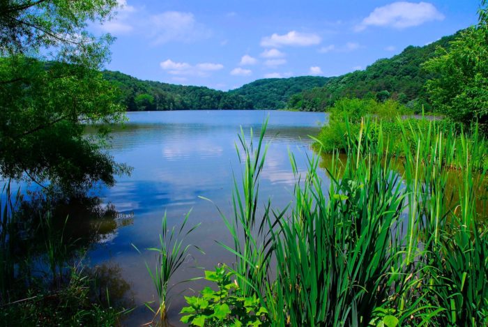
Pipestem State Park Trails
Hiking is a great year-round activity and is one of the most popular things to do at Pipestem. Choose from leisurely loops to challenging courses on the park’s 20 different hiking trails.
Easy
Dogwood Trail – 0.6 Miles
This relatively easy walking trail begins beside the pond at the Nature Center, passes through an oak-hickory forest along the park road, and loops back to the Nature Center.
Cottage Trail – 0.7 Miles
This easy trail begins at the park road behind Cottage Number 1 and travels down to Long Branch Lake, joining the Lake Shore Trail.
Lake Hollow Trail – 0.5 Miles
The trail begins at True Road and follows an old logging road down to the Lake Shore Trail just below the spillway for the dam.
Lake View Trail – 0.4 Miles
Beginning along the park road between the Recreation Center and the Nature Center, this trail follows an old roadbed through mostly open habitat to its junction with the Lake Shore Trail near Long Branch Lake.
North Side Trail – 0.3 Miles
This .5-mile loop trail begins at the Park Headquarters parking area, passes into the woods and returns to the large field behind the building.
Long Branch Trail – 0.3 Miles
Starting from the park road across from the McKeever Lodge and beside the arboretum, this short, steep paved trail offers easy access to Long Branch Lake. The trail also serves as a service road (authorized vehicles only).
South Side Trail – 0.6 Miles
This trail begins along park road 0.1 mile down the hill from Park Headquarters. It travels through mixed forest 0.6 miles to its junction with the Lake Shore Trail. Look for split rail fences, rock piles and other signs of early settlers.
Turkey Spur Trail – 1 Mile
This trail begins along the park road between Park Headquarters and Cottage Number 1, with a 0.3-mile unnamed trail to Turkey Spur. The trail connects Cottage and Lake Shore trails, and in 0.4 miles, joins with Lake Shore Trail.
Easy To Moderate
Canyon Rim Trail – 0.7 Miles
Beginning near the employee parking area at Canyon Rim Center, this steep trail descends 500 feet to Heritage Point, a massive sandstone outcropping. The overlook offers an excellent view of Bluestone River Gorge and Mountain Creek Lodge.
Bluestone Turnpike Trail – 8.5 Miles
This moderately difficult trail begins at Farley Loop and River Trail in Pipestem Resort State Park. From this intersection, it is 8.5 miles to Bluestone State Park. The trail is accessible near the aerial tram at the Mountain Creek Lodge. From the Mountain Creek Lodge, follow the River Trail downstream for one mile to access the beginning of the Bluestone Turnpike Trail. Access is also possible by hiking the entire length of the River Trail.
Moderate
Lake Shore Trail – 2.2 Miles
A relatively level shoreline and woodland trail completely encircling Long Branch Lake. May be reached via Law Hollow Trail, Den Tree, Long Branch, Cottage, Turkey Spur, South Side or Lake View Trails.
Farley Loop – 3 Miles
The most rugged trail in the park, Farley Loop Trail, begins behind the Mountain Creek Lodge. After a quarter mile of steep switchbacks, a short spur takes you to Raven Rock overlook and a tremendous view of the gorge. Another half mile of steep, rocky switchbacks takes you through a pine thicket to the patrol cabin. Above the cabin, the trail turns sharply to the right and passes two cemeteries before descending one mile to the Bluestone River. To return to Mountain Creek Lodge, turn right (upstream) and follow the River Trail.
County Line Trail – 1.9 Miles
This steep, somewhat rugged trail begins at the Nature Center parking lot, comes through and then travels a short distance toward the stables. It then descends into the woods, crosses two knobs, passes Indian Branch Falls (1.2 miles) and ends at the River Trail.
Lick Hollow – 1.6 Miles
This trail begins at the Mountain Creek Lodge parking area near Canyon Rim Center. It descends into Lick Hollow and then routes back up to the rim of the hollow with a beautiful view of the Bluestone Canyon. The trail then loops around and returns to the parking area.
Moderate To Difficult
River Trail – 5.25 Miles
This trail begins behind McKeever Lodge. After about a 0.25 mile of steep descent, the trail levels out. One and a half miles from the lodge, it crosses the Canyon Rim Trail. After passing under the Aerial Tramway, the trail meets the County Line Trail, about 2.25 miles from McKeever Lodge. The trail goes through a series of switchbacks for 1.25 miles to the Bluestone River. After wading the river, it is an easy 0.75-mile walk to Mountain Creek Lodge. The trail then continues downstream for another mile, ending at the junction of the Farley Loop Trail and the Bluestone Turnpike Trail.
Other ways to navigate our trails*
Additional information may be available in the West Virginia Trail Inventory
*Trail data may vary between services.

