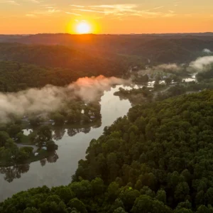
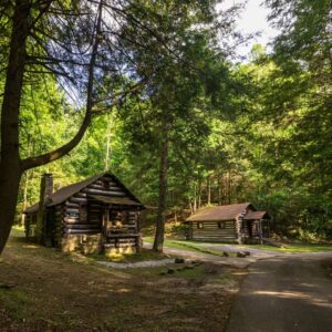
Holly River State Park Trails
Come see Holly River State Park’s rich woodlands, filled with abundant wildflowers. Hike one of the park’s many trails stretching 42 miles for a real scene stealer. Popular hikes include treks out to the Tecumseh and Tenskwatawa waterfalls and Potato Knob, which offers a commanding view of the park from 2,480 feet.
Easy
Laurel Fork Trail – 0.4 Miles
Located on the island between the Activity Building and the Carpenter Pavilion, the trail is asphalt paved and follows the perimeter of the island as it is encircled by Laurel Fork. The trail meets ADA standards and includes four rest stations, two shelters, three water fountains and 10 historical markers with Braille signs depicting the history of the park.
Nature’s Rock Garden Trail – 0.4 Miles
Beginning at the cabin area parking lot, this self-guided interpretive loop combines easy walking with a great variety of plant life. Interpretive booklets are available at the information kiosk.
Salt Lick Trail – 0.75 Miles
Beginning with a slight climb from Cabin No. 9, this trail winds around the mountain through a young forested area and leads to some of the oldest and largest trees in the park. The trail descends to the island in the picnic area and ends at the campground.
Moderate
High Rock Trail – 1.5 Miles
Starting from the footbridge below cabin No. 9, the trail begins a steep climb around a mountain, leading to a high tabletop rock on the ridge summit. The ridge is dominated by mountain laurel, flame azaleas and oak trees. The trail follows the ridge and descends to the mouth of Big Run and ends at the campground entrance.
Reverie Trail – 3.5 Miles
Originating at the campground entrance, the trail parallels Big Run to Dreamer’s Meadow, scales a mountain and passes under Tecumseh Falls, guiding hikers to a primitive camping site. Turning southeast, the trail descends the mountain to Pickens Road. From here, hikers can turn right on the road and walk back 1 mile to the starting point or cross the road to the stream and turn right on Wilderness Trail to the cabins.
Ridge Road Trail – 6.1 Miles
This trail is best for bicycling, day hiking and possibly cross-country skiing and horseback riding. It begins at Laurel Fork near the Jacob Klee Road and follows a jeep service road up the hill for about a mile to the old fire tower. It then follows the ridge to descend just behind the assistant superintendent’s residence at the lower end of the campground. Horseback riding is allowed on this trail.
Tramontane Trail – 2.5 Miles
Beginning at Cabin No. 9, this trail winds through a large forested area and out into the fields of an old homestead. From this point, the trail takes hikers to a high ridge overlooking the upper valley and headwaters to the left fork of Holly River. At approximately 2.3 miles, look for Mystic Falls, the hidden waterfall of Holly River State Park. The trail then descends into a dry run and on to its ending point at the picnic area.
Moderate to Difficult
Oak Ridge Trail – 2.5 Miles
Starting from the lower end of the campground, this trail ascends a mountain, then twists along Oak Ridge and intersects the Tramontane Trail. This trail features an overlook with a view of the park’s main recreational area.
Potato Knob Trail – 7.5 Miles (one way)
Branching off from Wilderness Trail, this trail follows a ridge to Ridge Road. It joins the road for a half mile and then descends the mountain through a grove of exceptionally large trees. A short side trail on the Ridge Road offers a view of Tenskwatawa Falls. Crossing Fall Run Road, the trail circles around the southern side of Potato Knob to The Chute. From here it is a steep ascent to the summit of Potato Knob.
Railroad Grade Trail – 10 Miles
The trail begins where Wilderness Trail crosses Crooked Fork. As the name implies, this trail travels an old railroad grade. In one area, this trail winds through some interesting rock formations.
Wilderness Trail – 4.5 Miles
Ascending the mountain through high country glens across Crooked Fork into a remote area of the park, the trail guides hikers from Cabin No. 9 to the former site of the fire tower. Backtracking is necessary to reach the original trail. Returning to and heading down Crooked Fork, the trail joins Laurel Fork and continues downstream, ending at Cabin No. 1.
Other ways to navigate our trails*


Additional information may be available in the West Virginia Trail Inventory
*Trail data may vary between services.