Trails at Babcock State Park
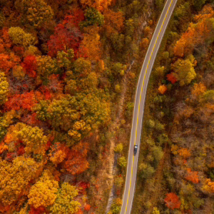
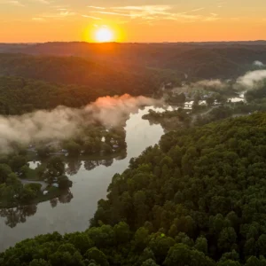
Ready to soak up scenic views? With 17 hiking and walking trails spanning more than 20 miles, Babcock State Park is the perfect destination for hikers of every level. Each trail boasts peaceful views and all offer a wide variety of terrain features.
Easy
Mountain Health Trail – 0.25 Miles
The trailhead is 300 yards north of the main intersection on the road leading to the Manns Creek picnic area. The parking spur is on the right side of the road, with the trailhead on the left. Numbered posts and a booklet available at park headquarters take you around this self-guided trail, which leads to the Natural Arch off from the right side of the parking spur.
The Natural Arch Trail – 0.2 Miles
Nature has a way of creating a natural wonder. It is an easy, short walk to this geologic fracture which can be combined with other trails such as Mountain Heath Trail for a longer walk. The Natural Arch is located approximately 75 yards from the parking area associated with Mountain Heath Trail.
Triple Creek Trail – 1 Mile
Get your steps in at this 3.8-mile loop trail near Danese, West Virginia. Generally considered an easy route, this trail takes about one hour and 32 minutes to complete. This trail is perfect for hiking and running, and it’s unlikely that you’ll encounter many other people while trekking the trail.
Wilderness Trail – 1.5 Miles
Wilderness Trail makes up a small portion of the 20-plus miles of hiking trails at Babcock State Park. Once you reach the Wilderness Trail junction, you will have the option to follow the loop on the right or go to a dead end on the left.
Easy To Moderate
Island in the Sky Trail – 0.5 Miles
The trailheads are at the grist mill and at a small parking lot in the sharp curve along the road to Boley Lake. The trail is mostly uphill if starting at the grist mill and mostly level if starting at the sharp curve. The trail has beautiful vistas and high cliff areas, so watch your children carefully.
Lake View Trail – 1 Miles
The trailheads to this mostly level loop around Boley Lake are at the lake parking lot or at the gate above the grist mill. A spur from the grist mill gate is 0.5 mile, uphill and moderately difficult. The metal bridge along this spur was originally a gangplank from the showboat Rhododendron.
Moderate
Connector Trail – 0.3 Miles
The trail head is located along the service road where Twin Hollow Trail crosses. This a short and steep trail connecting Twin Hollow Trail to Ridge Top Trail. Suitable for biking.
Manns Creek Gorge Trail – 2 Miles
The trailheads are across from Campsite 26 and at the first parking area at Camp Washington Carver. This is not a loop trail, so return along the same route or walk the Camp Washington Carver Road back to the campground. Suitable for mountain biking.
Narrow Gauge Trail – 2.5 Miles
The trailheads are at the service road between the campground and economy cabins and on Sewell Road approximately 0.75 mile below Cabin 13. The gentle grade follows the bed of Manns Creek Railway that connected Clifftop with Sewell until its closure in 1956. Railroad ties, telegraph poles and other remnants of the old railway are still evident. Mountain bikes are permitted but must be carried around difficult sections of the trail.
North Slope Trail – 0.5 Miles
The trailhead is shared with the Narrow Gauge Trail and is located next to Manns Creek Bridge on the service road. The first half of the trail is level and follows Manns Creek. The second half of the trail is very steep and is a difficult climb, connecting to the Ridge Top Trail. Suitable for biking.
Old Pond Trail – 1.5 Miles
The trailheads are at the parking lot for the Natural Arch and at the gate before the intersection to the Manns Creek overlook. The trail has some uphill sections from either starting point. Suitable for biking.
Ridge Top Trail – 2 Miles
The trailheads are across from the Short Cut Trail or past the Natural Arch parking area on the right – if you are coming from the main park entrance. The trail has steep uphill sections from either starting point. It follows along the crest of a ridge at some of the highest elevations at the park.
Short Cut Trail – 0.2 Miles
The trailhead is shared with the Ridge Top Trail parking area along Manns Creek Road. This has a fairly steep downhill section connecting to the Old Pond Trail. Biking is a great activity to do enjoy as well.
Skyline Trail – 2 Miles
The trailheads are at Manns Creek overlook in the picnic area and across the road from Cabin 5. Hikers must return along the same trail or by park roads. The trail follows a natural cliff line with spectacular vistas. It features a high cliff area, so watch your children carefully.
Twin Hollow Trail – 0.5 Miles
This route forms a more extended loop with Ridge Top Trail and Old Pond Trail. In the counterclockwise direction, this adds a short and steep climb on washboarded trail. Enjoy scenic views no matter where you are on the route.
Moderate To Challenging
Old Sewell Trail – 9 Miles
Official trailhead located below cabin #13. Parking available at the Administration Building and Grist Mill lots. Once part of the Narrow Gauge Railroad, this trail is moderate with a gradual, downhill grad and leads to the former mining town of Sewell, featuring different flora and fauna, a coal boiler, and waterfalls. Trail leaves Babcock State Park and enters the New River Gorge National Park & Preserve.
Challenging
Rocky Trail – 0.5 Miles
This short, steep trail connects Skyline Trail with Narrow Gauge Trail and is a stone staircase constructed by the Civilian Conservation Corps in the 1930s. For an easier hike, walk downhill from the Skyline Trail.
Other ways to navigate our trails*


Additional information may be available in the West Virginia Trail Inventory
*Trail data may vary between services.