Lost River State Park Trails
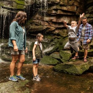
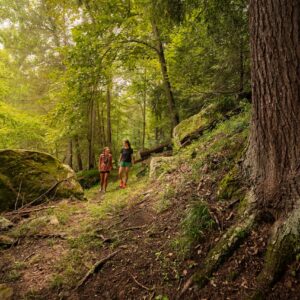
The 23 miles of trails within Lost River State Park are abundant with nature and striking views. Extensive wildlife and fresh flowers make for an enchanting experience around 3,934 wooded acres. Several trails amid the park are suitable for mountain biking and horseback riding, with professional guides to accompany you. There is a rewarding discovery with every step, including the “Millers Rock” trail, which leads to Cranny Crow overlook for sweeping panoramic views.
Easy
Howard Lick Trail – 1.25 Miles
This trail runs from the parking lot near Cabin No. 3 or the nearby picnic area to the junction of East Ridge Trail near the park’s east entrance.
Lee Sulphur Spring Trail – 0.25 Miles
This trail begins at the Lee Sulphur Spring and runs along the creek to the Athletic ballfield and Shelter #2 area.
Loblolly Trail – 0.875 Miles
This trail runs from the end of the road near the storage building to the end of Cabin Run Road.
Moderate
Arbutus Trail – 0.75 Miles
This trail runs from East Ridge Trail to Loblolly Trail near storage building.
Big Ridge Trail – 1 Mile
This trail runs from the lower Fire Tower Road around Big Ridge and back onto Fire Tower Road on top of Big Ridge.
Branch Mountain Trail – 0.5 Miles
This trail runs from Shingle Mill Land Trail near the lower picnic area to the top of the ridge, rejoining Shingle Mill Land Trail.
Copse Cove Trail – 1.75 Miles
This trail runs from the Lee Sulphur Spring near Cabin No. 1 or across from the parking lot near Cabin No. 2 to the intersection of Light Horse Harry Lee Trail.
Covey Cove Trail – 0.5 Miles
This trail runs from the end of Cabin Run Road to Light Horse Harry Lee Trail and then to Piney Ridge Road. (Mountain bikers welcome.)
East Ridge Trail – 2.5 Miles
This trail runs from Howard’s Lick Run near the east entrance to the intersection of Red Fox Trail and Light Horse Harry Lee Trail near the southwest corner of the park. (Mountain bikers welcome.)
Laurel Trail – 0.5 Miles
This trail runs from the administration building to the junction of Razor Ridge Trail.
Lee Trail – 0.5 Miles
This trail starts at Cabin No. 8 and crosses Light Horse Harry Lee Trail to Copse Cove Trail.
Lighthorse Harry Lee Trail – 1.25 Miles
This horse trail runs from the playground across from the administration building to the junction of East Ridge Trail and Red Fox Trail.
Millers Rock Trail – 3.5 Miles
This trail starts at the White Oak trailhead at the horse stables and leads to the Cranny Crow overlook at an elevation of 3,200 feet, offering a scenic panorama of five counties.
Razors Ridge Trail – 1.25 Miles
This trail runs from the parking lot near the swimming pool and Cabin No. 3 at the intersection of Howard Lick Trail to East Ridge Trail.
Red Fox Trail – 0.5 Miles
This trail runs from East Ridge Trail to Piney Ridge Road near the southwest corner of the park. (Mountain bikers welcome.)
Shingle Mill Lane Trail – 1 Mile
This horse trail runs from the stables to the lower picnic area.
Staghorn Trail – 1 Mile
This trail runs from East Ridge Trail to Cabin Run Road near Cabin No. 17.
Virginia View Trail – 0.625 Miles
This trail runs from Miller’s Rock Trail at Cheeks Rocks to Big Ridge Trail near Big Ridge Picnic Shelter.
White Oak Trail – 1.5 Miles
This horse trail runs from the stable to the top of Big Ridge at the junction of Miller’s Rock Trail.
Wood Thrush Trail – 0.25 Miles
This trail runs from East Ridge Trail to Staghorn Trail.
Other ways to navigate our trails*


Additional information may be available in the West Virginia Trail Inventory
*Trail data may vary between services.