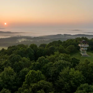
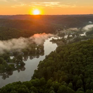
River Access Points at Elk River Trail
River access points can be found at Duck, King Shoals, Queen Shoals, Blue Creek and Charleston.
River Access Points
Duck
The Duck public river access point is in the town of Duck, a quarter mile south of the Clay-Braxton county line. The access point includes a concrete ramp, ideal for transporting small boats like canoes and kayaks. There are concrete steps along the ramp and a pad at the bottom for boat entry and exit. Fifteen parking spots are available on a gravel lot along the Elk River.
Directions to Duck Trailhead and River Access Point:
Take I-79 Exit 46, then take Servia Road (CR-11) toward Duck until the road ends at the Elk River. Turn right onto State Route 4 South for 0.3 miles, then turn left onto Villanova Ridge Road. When you cross the bridge, the parking lot is on the right.
King Shoals
The King Shoals public river access point is 9.5 miles east of Clendenin on State Route 4 near the Kanawha-Clay county line. The access point includes a concrete ramp, ideal for transporting small boats like canoes and kayaks. There are concrete steps along the ramp and a pad at the bottom for boat entry and exit. Nine parking spots are available on a gravel lot between Route 4 and the Elk River.
Directions to King Shoals River Access from Charleston:
Take I-79 North to Exit 19 Clendenin. Turn right toward Clendenin for 0.3 miles. Turn left onto State Route 4 and follow it for 9.5 miles. The location is on your right next to the river. If you pass the Camp Creek bridge, you’ve gone too far.
Queen Shoals
The Queen Shoals public access point is nearly 4 miles northeast of Clendenin on State Route 4 near the Queen Road bridge that crosses the Elk River. The access point includes a concrete ramp and steps for transporting small boats like canoes and kayaks. The bank along the Elk River is level and has a sand bar where visitors will often swim. The Queen Shoals location includes eight parking spots on a dirt lot. Additional parking is available at the top of the embankment next to River Haven Road and is just a short walk down the gravel road to the river.
Directions to Queen Shoals River Access from Charleston:
Take I-79 North to Exit 19 Clendenin. Turn right onto 119 South toward Clendenin for 0.3 miles. When the road ends, turn left onto State Route 4 and follow it for 4 miles until you reach Queen Road on your right. Turn right to cross the bridge, then make an immediate left turn onto River Haven Road. The location is on your left, down the embankment next to the river.
Blue Creek
The Blue Creek public river access point is on State Route 119 beneath what’s commonly referred to as the Blue Creek bridge. The access point includes a concrete ramp, ideal for transporting small boats like canoes and kayaks. There are concrete steps along the ramp and a pad at the bottom for boat entry and exit. At least eight parking spots are available on a gravel lot underneath the bridge.
Directions to Blue Creek River Access Point:
Take I-79 Exit 9. Take Frame Road (CR-11) toward Elkview until the road ends at the stop sign. Turn left onto US Route 119 North for 1.3 miles. Just before you get to the bridge, take the dirt road that veers off to the right between the storage business and the homes on the left.
Charleston
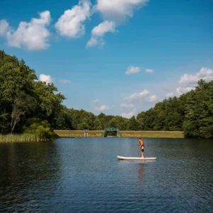
The Charleston River access point is at the Charleston Coliseum & Convention Center. A kayak launch ramp is available, and kayakers can load their craft into a dry chute, sit down in their kayak and launch themselves onto the water. The river is gentler and less swift here, allowing kayakers to paddle upstream. Kayakers can enter and exit the river from this launch point, which is often difficult in the swift water found at upstream launch points.
The launch is free for public use daily from 7:00 AM-9:00 PM and can accommodate single and tandem kayaks, paddleboards and most canoes. Free parking is available at the Charleston Coliseum & Convention Center’s boat dock.
Directions to Charleston Coliseum and Convention Center River Access Point
From the East:
From I-64 or I-77, take the Washington Street and Civic Center Drive exit (Exit 58C)
Continue straight on Pennsylvania Avenue
Turn Left onto Virginia Street
Merge to the far left lane immediately
Turn Left onto Civic Center Drive
Turn Left on Quarrier Street
The Center Parking Building entrance is on the immediate right
From the West:
Take the Virginia Street exit (Exit 58B) on I-64
Stay to the right as you exit, and this will put you on Virginia Street
Merge to the far left lane immediately
Turn Left onto Civic Center Drive
Turn Left on Quarrier Street
The Center Parking Building entrance is on the immediate right