Camp Creek State Park Trails
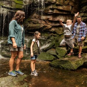
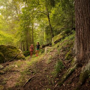
Thirty-five miles of scenic hiking trails will be at your fingertips at Camp Creek State Park and Forest! Enjoy a casual stroll along the Horse Bypass Trail or test your hiking skills on a more difficult path like the Piney Ridge Trail.
Easy
Almost Heaven Road and Trail – 0.6 Miles
Although this trail is a level grade, it must first be accessed by hiking 2.3 miles along the Farley Ridge Road and Trail.
Horse Bypass Trail – 0.7 Miles
This trailhead starts across the paved road from the Mash Fork Picnic Shelter at the beginning of the gravel road leading to Mash Fork Falls. This level trail is used to bypass the shelter and picnic areas in the developed area of the park. This is required of all horses and riders as they are not allowed in the main picnic areas. It is also a nice bypass for hikers choosing to use it.
Waldron Spur Road and Trail – 0.75 Miles
This trailhead is next to the seasonal hunter parking area 2.
White Oak Road and Trail – 1.4 Miles
This trail starts 1.2 miles upstream on Turkey Loop Road and Trail from the Campbell Falls/Forest Access. At the bottom of the seasonal hunter parking area, enter this easy trail through a thick grove of rhododendron on either side.
Moderate
Bear Wallow Road and Trail – 0.6 Miles
This is a loop trail that starts and ends above the Falls/Forest Access parking area.
Blue Jay Ridge Road and Trail – 2.3 Mile
This trail is best accessed by parking at the Campbell Falls/Forest Access parking area and hiking past Campbell Falls on the Turkey Loop Road and Trail 1.9 miles to the trailhead on the left just past Wildlife Area 1. The trail, with multiple finger ridges running perpendicular o either side of trail, runs along Blue Jay Ridge Road and Trail for 2.3 miles before intersecting with the Blue Jay Spur Trail. At this point you may hike the Blue Jay Spur Trail for 1 mile to return to the beginning point. Total distance for this described hike is 5.3 miles.
Deer Crossing Road and Trail – 1.2 Miles
This scenic trail connects the two longest trails in the forest — Bear Wallow and Turkey Loop — by crossing through Wildlife Area 7 and Bear Creek and joining with White Oak Road and Trail.
Farley Ridge Road and Trail – 3.3 Miles
This trailhead is across the paved park road from the playground next to the basketball court.
Hatfield Road and Trail – 2 Miles
This trail is best accessed by a 1-mile hike along White Oak Road & Trail.
Turkey Loop Road and Trail – 8.7 Miles
This trailhead is located at the Campbell Falls/Forest Access parking area. On this trail, there are nine creek crossings and a tributary stream to ford before crossing the bridge below Mash Fork Falls, so keep the water level in mind. Most of the park and forest trails to the west of Bear Creek intersect at some point with Turkey Loop Road and Trail.
McCoy Road and Trail – 1.8 Miles
This trail is accessed from either the Turkey Loop or Farley Ridge Road and Trails.
Neely Knob Road and Trail – 2 Miles
This trail passes through a variety of habitats, including Wildlife Area 9, and is relatively easy for much of the way and moderately steep in others. The trail also passes by the highest elevation peak, Neely Knob, and has several beautiful views of the distant mountains.
Blue Jay Spur Trail – 1 Mile
This trailhead is to the right of Blue Jay Campground site 12. Begin by parking at the Campbell Falls/Forest parking area and ascending along the trail before leveling out along the contour of the mountain for great views of Camp Creek below. At the .9 mile mark, the trail intersects with Farley Ridge Trail to the left or turn right and ascend to the top of the mountain to join Blue Jay Ridge Trail.
Difficult
Marsh Fork Falls Trail – 0.6 Miles
This steep scenic trail may be accessed by parking at the playground next to the basketball court and hiking .8 mile on the Farley Ridge trail to the trailhead of Mash Fork Falls Trail.
Piney Ridge Trail – 1.5 Miles
This steep scenic trail may be accessed by parking next to the Mash Fork picnic shelter or by sites 23 and 24 at the Mashfork Campground. This is a loop trail.


Additional information may be available in the West Virginia Trail Inventory
*Trail data may vary between services.